Featured Day Trips
Pioneer Park to Pump House
Enjoy a leisurely 2-3 hour float down the Chena River from Pioneer Park to the Pump House Restaurant. Hop in our shuttle at the end for a ride back. Our most popular float!
Scenic Lower Chena Float
A 5 hour float along the Chena River from Nordale Bridge to Pioneer Park. Keep an eye out for various animals such as beavers, eagles, and the occasional Moose!
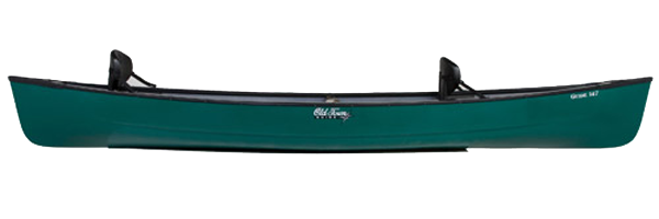
Canoes
We rent canoes from Old Town and Dagger. From a short float down the Chena River, to a day of fishing on a lake, or an Alaskan wilderness expedition, we have the boats for you. We are your Alaskan canoe rental experts.
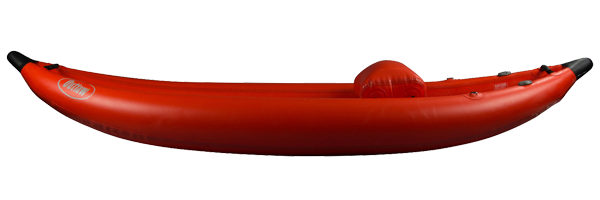
Inflatables
Rent an inflatable kayak or canoe from us. Paddle our high-quality solo and tandem boats from NRS, Grabner, SOAR and Aquaglide. Inflatables are easy to transport, and they offer a comfortable, user-friendly way to explore Alaskan waterways. A great option for the many fly in wilderness trips throughout Alaska!
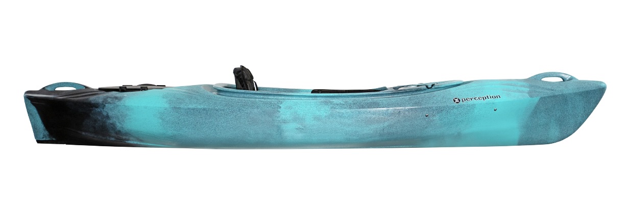
Kayaks
Canoe Alaska rents recreational and touring kayaks. Choose from solo, tandem and sit on top kayak models from LiquidLogic, Necky, Old Town, and Manta. Explore Alaska’s rivers and Lakes in comfort and style with a kayak rental from our paddlesports shop in Fairbanks.
SUP’s
Rent a Stand up Paddle Board from Canoe Alaska and discover why these watercraft have become so popular. We offer three stable, multi-purpose and cruiser models for Stand-up Paddleboarding fun!

Paddlesport Rental Rates
CanoeAlaska Rental rates for Canoes, Kayaks, Inflatables, and SUP's - Paddles and PFD's (life vests) included in rental. (On a smartphone, click the green + icon to see all rates)| Boat Rentals | 8 hours | 24 hours | Weekend | Week |
|---|---|---|---|---|
| Old Town and Dagger Canoes | $55 | $80 | $150 | $250 |
| LiquidLogic and Necky Kayaks | $55 | $80 | $150 | $250 |
| Stand-up Paddleboards | $55 | $80 | $150 | $250 |
| Inflatable Kayaks | $55 | $80 | $150 | $250 |
| Grabner Outside Inflatable Canoe | $60 | $95 | $180 | $280 |
| SOAR Explorer Inflatable Canoe | $65 | $100 | $200 | $300 |
Remote Shuttle Services
Planning your own Interior Alaska river trip? Need help with arranging shuttle logistics between your put-in and take-out? Contact CanoeAlaska about our custom shuttle services. We also offer bike rentals. Bicycle shuttles are popular for day trips on the Upper Chena and Chatanika Rivers.

Wilderness Trips
If you are an experienced paddler and would like to explore any of Alaska’s beautiful wild and scenic rivers, look no further! We can help make your dream trip a reality, providing shuttle services, and gear rental. Contact us today to start planning your adventure!